★ 11k pts. ♥ 0 le gusta ⬇ 3 guardados
 Pict. [Mapporn] London Underground Map, 2020. [2500x1648] (#Map #London #Underground #2500x1648)Pict. 2500×1648 px
★ 6015 pts. ♥ 0 le gusta ⬇ 8 guardados
![[Mapporn] London Underground Map, 2020. [2500x1648] (#Map #London #Underground #2500x1648) - 624 KB Tags: 2500x1648, london, map, underground (Pict. in My r/MAPS favs)](https://t.im9.eu/mapporn-london-underground-map-2020-2500x1648.jpg) Pict. [Mapporn] Hand crafted topographical map of Banks Peninsula, New Zealand (Contour lines are at 100m intervals. More maps in comm (#New #Map #Are #Hand #Lines #Comm #Contour #Crafted #Intervals)Pict. 960×720 px
Pict. [Mapporn] Hand crafted topographical map of Banks Peninsula, New Zealand (Contour lines are at 100m intervals. More maps in comm (#New #Map #Are #Hand #Lines #Comm #Contour #Crafted #Intervals)Pict. 960×720 px★ 8978 pts. ♥ 0 le gusta ⬇ 20 guardados
![[Mapporn] Hand crafted topographical map of Banks Peninsula, New Zealand (Contour lines are at 100m intervals. More maps in comm (#New #Map #Are #Hand #Lines #Comm #Contour #Crafted #Intervals) - 137 KB Tags: are, banks, comm, contour, crafted, hand, intervals, lines, map, maps, new, peninsula, topographical, zealand (Pict. in My r/MAPS favs)](https://t.im9.eu/mapporn-hand-crafted-topographical-map-of-banks-peninsula-new-zealand-contour-lines-are-at-100m-intervals-more-maps-in-comments-oc-960x720.jpg) Pict. [Mapporn] Map of the Roman Empire under the rule of Hadrian (117–138) [2186x1817] (#Map #Rule #Empire #Roman #Hadrian)Pict. 2186×1817 px
Pict. [Mapporn] Map of the Roman Empire under the rule of Hadrian (117–138) [2186x1817] (#Map #Rule #Empire #Roman #Hadrian)Pict. 2186×1817 px★ 5906 pts. ♥ 0 le gusta ⬇ 10 guardados
![[Mapporn] Map of the Roman Empire under the rule of Hadrian (117–138) [2186x1817] (#Map #Rule #Empire #Roman #Hadrian) - 715 KB Tags: empire, hadrian, map, roman, rule (Pict. in My r/MAPS favs)](https://t.im9.eu/mapporn-map-of-the-roman-empire-under-the-rule-of-hadrian-117-138-2186x1817.jpg) Pict. [Mapporn] Map of a survey asking the world who they sees as the biggest threat to world peace [1,920x1,080] (#World #Map #Sees #Survey #Threat)Pict. 1920×1080 px
Pict. [Mapporn] Map of a survey asking the world who they sees as the biggest threat to world peace [1,920x1,080] (#World #Map #Sees #Survey #Threat)Pict. 1920×1080 px★ 6174 pts. ♥ 0 le gusta ⬇ 13 guardados
![[Mapporn] Map of a survey asking the world who they sees as the biggest threat to world peace [1,920x1,080] (#World #Map #Sees #Survey #Threat) - 258 KB Tags: biggest, map, peace, sees, survey, threat, world (Pict. in My r/MAPS favs)](https://t.im9.eu/mapporn-map-of-a-survey-asking-the-world-who-they-sees-as-the-biggest-threat-to-world-peace-1-920x1-080.jpg) Pict. [Mapporn] Ethno-genetic map of Europe [1600×1441] (#Map #Europe #Genetic #Ethno)Pict. 1600×1441 px
Pict. [Mapporn] Ethno-genetic map of Europe [1600×1441] (#Map #Europe #Genetic #Ethno)Pict. 1600×1441 px★ 5250 pts. ♥ 0 le gusta ⬇ 11 guardados
![[Mapporn] Ethno-genetic map of Europe [1600×1441] (#Map #Europe #Genetic #Ethno) - 261 KB Tags: ethno, europe, genetic, map (Pict. in My r/MAPS favs)](https://t.im9.eu/mapporn-ethno-genetic-map-of-europe-1600-1441.jpg) Pict. [Gaming] The size of Chernarus (DayZ) compared to the average COD and Battlefield map (dayz) (#Gaming #Map #Size #Battlefield #Dayz #Chernarus)Pict. 1271×2027 px
Pict. [Gaming] The size of Chernarus (DayZ) compared to the average COD and Battlefield map (dayz) (#Gaming #Map #Size #Battlefield #Dayz #Chernarus)Pict. 1271×2027 px★ -371 pts. ♥ 0 le gusta ⬇ 12 guardados
![[Gaming] The size of Chernarus (DayZ) compared to the average COD and Battlefield map (dayz) (#Gaming #Map #Size #Battlefield #Dayz #Chernarus) - 470 KB Tags: average, battlefield, chernarus, cod, compared, dayz, gaming, map, size (Pict. in My r/GAMING favs)](https://t.im9.eu/gaming-the-size-of-chernarus-dayz-compared-to-the-average-cod-and-battlefield-map-dayz.jpg) Pict. [Mapporn] World Map showing the full extent of the European Union (including its Outermost Regions), its Overseas Countries and (#World #Map #Full #Showing #Including #Overseas #Extent #Outermost)Pict. 2206×1358 px
Pict. [Mapporn] World Map showing the full extent of the European Union (including its Outermost Regions), its Overseas Countries and (#World #Map #Full #Showing #Including #Overseas #Extent #Outermost)Pict. 2206×1358 px★ 8935 pts. ♥ 0 le gusta ⬇ 9 guardados
![[Mapporn] World Map showing the full extent of the European Union (including its Outermost Regions), its Overseas Countries and (#World #Map #Full #Showing #Including #Overseas #Extent #Outermost) - 288 KB Tags: countries, european, extent, full, including, map, outermost, overseas, regions, showing, union, world (Pict. in My r/MAPS favs)](https://t.im9.eu/mapporn-world-map-showing-the-full-extent-of-the-european-union-including-its-outermost-regions-its-overseas-countries-and-territories-exclusive-economic-zones-and-antarctic-claims-2206x1358.jpg) Pict. [Mapporn] Remaking (again) my 'ethnic' map of the world. Really confusing what is and what isn't an ethnicity. [4972x2517] (#World #Map #Isn #4972x2517 #Remaking)Pict. 4972×2517 px
Pict. [Mapporn] Remaking (again) my 'ethnic' map of the world. Really confusing what is and what isn't an ethnicity. [4972x2517] (#World #Map #Isn #4972x2517 #Remaking)Pict. 4972×2517 px★ 7177 pts. ♥ 0 le gusta ⬇ 6 guardados
![[Mapporn] Remaking (again) my 'ethnic' map of the world. Really confusing what is and what isn't an ethnicity. [4972x2517] (#World #Map #Isn #4972x2517 #Remaking) - 1.1 MB Tags: 4972x2517, confusing, ethnic, ethnicity, isn, map, remaking, world (Pict. in My r/MAPS favs)](https://t.im9.eu/mapporn-remaking-again-my-ethnic-map-of-the-world-really-confusing-what-is-and-what-isn-t-an-ethnicity-4972x2517.jpg) Pict. [Mapporn] The same USA 'Voter Ethnicity' map, presented as county data rather than as a population density map (as per a convers (#Map #Population #County #Usa #Presented #Ethnicity #Convers)Pict. 3979×2262 px
Pict. [Mapporn] The same USA 'Voter Ethnicity' map, presented as county data rather than as a population density map (as per a convers (#Map #Population #County #Usa #Presented #Ethnicity #Convers)Pict. 3979×2262 px★ 8027 pts. ♥ 0 le gusta ⬇ 6 guardados
![[Mapporn] The same USA 'Voter Ethnicity' map, presented as county data rather than as a population density map (as per a convers (#Map #Population #County #Usa #Presented #Ethnicity #Convers) - 947 KB Tags: convers, county, data, density, ethnicity, map, per, population, presented, usa, voter (Pict. in My r/MAPS favs)](https://t.im9.eu/mapporn-the-same-usa-voter-ethnicity-map-presented-as-county-data-rather-than-as-a-population-density-map-as-per-a-conversation-with-another-redditor-in-the-comments-section-of-the-other-map-5684-x-3232.jpg) Pict. [Mapporn] Areas of Cardiff, Wales potentially effected by reservoir flooding. [1570x938] (Country-wide interactive map in the co (#Map #Wide #Country #Reservoir #Flooding)Pict. 1570×938 px
Pict. [Mapporn] Areas of Cardiff, Wales potentially effected by reservoir flooding. [1570x938] (Country-wide interactive map in the co (#Map #Wide #Country #Reservoir #Flooding)Pict. 1570×938 px★ 7140 pts. ♥ 0 le gusta ⬇ 16 guardados
![[Mapporn] Areas of Cardiff, Wales potentially effected by reservoir flooding. [1570x938] (Country-wide interactive map in the co (#Map #Wide #Country #Reservoir #Flooding) - 254 KB Tags: areas, country, flooding, interactive, map, reservoir, wales, wide (Pict. in My r/MAPS favs)](https://t.im9.eu/mapporn-areas-of-cardiff-wales-potentially-effected-by-reservoir-flooding-1570x938-country-wide-interactive-map-in-the-comments.jpg) Pict. [Gonewild] On-Off in my Map o[f] Middle Earth dress. 2 (#Map #Dress #Earth)Pict. 3264×3264 px
Pict. [Gonewild] On-Off in my Map o[f] Middle Earth dress. 2 (#Map #Dress #Earth)Pict. 3264×3264 px★ 10k pts. ♥ 0 le gusta ⬇ 3 guardados
![[Gonewild] On-Off in my Map o[f] Middle Earth dress. 2 (#Map #Dress #Earth) - 967 KB Tags: dress, earth, map (Pict. in My r/GONEWILD favs)](https://t.im9.eu/gonewild-on-off-in-my-map-o-f-middle-earth-dress-2.jpg) Pict. [Mapporn] Map of the British Empire on the world's first Christmas stamp [838x621] (#World #Map #Christmas #British #Empire #Stamp)Pict. 838×621 px
Pict. [Mapporn] Map of the British Empire on the world's first Christmas stamp [838x621] (#World #Map #Christmas #British #Empire #Stamp)Pict. 838×621 px★ 6102 pts. ♥ 0 le gusta ⬇ 20 guardados
![[Mapporn] Map of the British Empire on the world's first Christmas stamp [838x621] (#World #Map #Christmas #British #Empire #Stamp) - 206 KB Tags: british, christmas, empire, map, stamp, world (Pict. in My r/MAPS favs)](https://t.im9.eu/mapporn-map-of-the-british-empire-on-the-world-s-first-christmas-stamp-838x621.jpg) Pict. [Mapporn] Older map of US tornado tracks, but cool nonetheless. [2670x1447] (#Map #But #Older #Cool #Tornado #Tracks)Pict. 2670×1447 px
Pict. [Mapporn] Older map of US tornado tracks, but cool nonetheless. [2670x1447] (#Map #But #Older #Cool #Tornado #Tracks)Pict. 2670×1447 px★ 5808 pts. ♥ 0 le gusta ⬇ 14 guardados
![[Mapporn] Older map of US tornado tracks, but cool nonetheless. [2670x1447] (#Map #But #Older #Cool #Tornado #Tracks) - 741 KB Tags: but, cool, map, older, tornado, tracks (Pict. in My r/MAPS favs)](https://t.im9.eu/mapporn-older-map-of-us-tornado-tracks-but-cool-nonetheless-2670x1447.jpg) Pict. [Mapporn] A map of Operation Tannenbaum: Hitler's planned - but ultimately cancelled - invasion of Switzerland during WWII [1024 (#Map #Hitler #Switzerland #Invasion #Cancelled #Ultimately #Tannenbaum)Pict. 1024×666 px
Pict. [Mapporn] A map of Operation Tannenbaum: Hitler's planned - but ultimately cancelled - invasion of Switzerland during WWII [1024 (#Map #Hitler #Switzerland #Invasion #Cancelled #Ultimately #Tannenbaum)Pict. 1024×666 px★ 8332 pts. ♥ 0 le gusta ⬇ 14 guardados
![[Mapporn] A map of Operation Tannenbaum: Hitler's planned - but ultimately cancelled - invasion of Switzerland during WWII [1024 (#Map #Hitler #Switzerland #Invasion #Cancelled #Ultimately #Tannenbaum) - 225 KB Tags: cancelled, hitler, invasion, map, operation, planned, switzerland, tannenbaum, ultimately, wwii (Pict. in My r/MAPS favs)](https://t.im9.eu/mapporn-a-map-of-operation-tannenbaum-hitler-s-planned-but-ultimately-cancelled-invasion-of-switzerland-during-wwii-1024x666.jpg) GIF [Mapporn] Poland's Territory 1635-2009 [380x313][GIF] (#Gif #Map #Poland #Territory)GIF 380×313 px
GIF [Mapporn] Poland's Territory 1635-2009 [380x313][GIF] (#Gif #Map #Poland #Territory)GIF 380×313 px★ 5385 pts. ♥ 0 le gusta ⬇ 6 guardados
![[Mapporn] Poland's Territory 1635-2009 [380x313][GIF] (#Gif #Map #Poland #Territory) - 1.5 MB Tags: gif, map, poland, territory (GIF in My r/MAPS favs)](https://t.im9.eu/mapporn-poland-s-territory-1635-2009-380x313-gif.jpg) GIF [Mapporn] Attitudes Toward Jews in Ten European Countries [826x680] (#Map #Europe #European #826x680 #Attitudes)GIF 826×680 px
GIF [Mapporn] Attitudes Toward Jews in Ten European Countries [826x680] (#Map #Europe #European #826x680 #Attitudes)GIF 826×680 px★ 7256 pts. ♥ 0 le gusta ⬇ 9 guardados
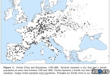
![[Mapporn] Attitudes Toward Jews in Ten European Countries [826x680] (#Map #Europe #European #826x680 #Attitudes) - 914 KB Tags: 826x680, attitudes, countries, europe, european, jews, map, ten (GIF in My r/MAPS favs)](https://t.im9.eu/mapporn-attitudes-toward-jews-in-ten-european-countries-826x680.jpg) Pict. The Long Data of European Jewish Expulsions (map) (#Map #Long #European #Data #Jewish #Expulsions)Pict. 660×504 px
Pict. The Long Data of European Jewish Expulsions (map) (#Map #Long #European #Data #Jewish #Expulsions)Pict. 660×504 px★ 6100 pts. ♥ 0 le gusta ⬇ 5 guardados
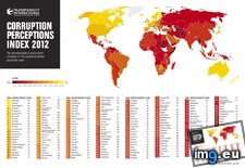
 Pict. Corruption Perceptions Index 2012 (map with ranks) - Transparency International (#Map #International #Corruption #Perceptions #Transparency)Pict. 1280×840 px
★ 7346 pts. ♥ 0 le gusta ⬇ 5 guardados
 Pict. [Mapporn] Map of Vatican City [2,888×2,230] (#Map #City #Vatican)Pict. 2888×2230 px
★ 4966 pts. ♥ 0 le gusta ⬇ 6 guardados
![[Mapporn] Map of Vatican City [2,888×2,230] (#Map #City #Vatican) - 657 KB Tags: city, map, vatican (Pict. in My r/MAPS favs)](https://t.im9.eu/mapporn-map-of-vatican-city-2-888-2-230.jpg) Pict. [Mapporn] Magellan's Circumnavigation of the Earth, from the Portolan Atlas by Battista Agnese, c. 1544. [2235x1482] (#Old #Map #Earth #Atlas)Pict. 2235×1482 px
Pict. [Mapporn] Magellan's Circumnavigation of the Earth, from the Portolan Atlas by Battista Agnese, c. 1544. [2235x1482] (#Old #Map #Earth #Atlas)Pict. 2235×1482 px★ 52k pts. ♥ 1 le gusta ⬇ 17 guardados
![[Mapporn] Magellan's Circumnavigation of the Earth, from the Portolan Atlas by Battista Agnese, c. 1544. [2235x1482] (#Old #Map #Earth #Atlas) - 574 KB Tags: atlas, earth, map, old (Pict. in My r/MAPS favs)](https://t.im9.eu/mapporn-magellan-s-circumnavigation-of-the-earth-from-the-portolan-atlas-by-battista-agnese-c-1544-2235x1482.jpg) Pict. [Mapporn] Ethno-religious map of Afghanistan and surrounding countries [1000x877] (#Map #Countries #Afghanistan #Religious #Surrounding #Ethno)Pict. 1000×877 px
Pict. [Mapporn] Ethno-religious map of Afghanistan and surrounding countries [1000x877] (#Map #Countries #Afghanistan #Religious #Surrounding #Ethno)Pict. 1000×877 px★ 6770 pts. ♥ 0 le gusta ⬇ 14 guardados
![[Mapporn] Ethno-religious map of Afghanistan and surrounding countries [1000x877] (#Map #Countries #Afghanistan #Religious #Surrounding #Ethno) - 158 KB Tags: afghanistan, countries, ethno, map, religious, surrounding (Pict. in My r/MAPS favs)](https://t.im9.eu/mapporn-ethno-religious-map-of-afghanistan-and-surrounding-countries-1000x877.jpg) Pict. Racism Map - worlds most and least racially tolerant countries map (#Map #Countries #Worlds #Racism #Racially #Tolerant)Pict. 1248×617 px
Pict. Racism Map - worlds most and least racially tolerant countries map (#Map #Countries #Worlds #Racism #Racially #Tolerant)Pict. 1248×617 px★ 5880 pts. ♥ 0 le gusta ⬇ 3 guardados
 Pict. [Mapporn] The sub asks for interesting maps: this map I found online is interestingly wrong! [1050x1443] (#Map #Interesting #Wrong #Sub #Interestingly)Pict. 1050×1443 px
★ 6882 pts. ♥ 0 le gusta ⬇ 11 guardados
![[Mapporn] The sub asks for interesting maps: this map I found online is interestingly wrong! [1050x1443] (#Map #Interesting #Wrong #Sub #Interestingly) - 175 KB Tags: asks, interesting, interestingly, map, maps, online, sub, wrong (Pict. in My r/MAPS favs)](https://t.im9.eu/mapporn-the-sub-asks-for-interesting-maps-this-map-i-found-online-is-interestingly-wrong-1050x1443.jpg)