- 10 visto: [Mapporn] [OC] Solar Energy in USA from 2001…
- 9 visto: [Mapporn] If the world map was made by someo…
- 9 visto: [Mapporn] Amount of snow required to cancel …
- 8 visto: [Mapporn] Historical Map of the NYC Subway s…
- 8 visto: [Mapporn] Historical Disaster Declarations …
- 8 visto: [Mapporn] Physicians Density around the worl…
- 8 visto: [Mapporn] Stadiums with 60k+ capacity in UK …
- 8 visto: [Mapporn] Road deaths in Europe per million …
- 38 guardados: [Mapporn] Number of Women per 100 Men in the Age …
- 37 guardados: [Mapporn] Top rated films on IMDb set and shot in…
- 34 guardados: [Mapporn] In honour of the recent Sami National D…
- 34 guardados: [Mapporn] Educational Background of World Leaders…
- 4917 visto: [Mapporn] Top rated films on IMDb set a…
- 2840 visto: [Mapporn] Age of Vikings - Scandinavian…
- 2003 visto: [Mapporn] Top rated films on IMDB set i…
- 1854 visto: [Mapporn] Educational Background of Wor…
- Rated: General ❀ Family friendly
- Album tamaño: 2.3 GB
- Imágenes: 4287
- Visto: 248601 (147 hoy)
- Último visto: 5 minutes hace
- Creado: 12 years hace
- Ver también:
★ 56k pts. ♥ 1 le gusta ⬇ 16 guardados
![[Mapporn] Percentage of population watching domestic football-soccer leagues in Europe. [2100x1525] (#Europe #Population #Football #2100x1525 #Domestic #Leagues) - 287 KB Tags: 2100x1525, domestic, europe, football, leagues, percentage, population, soccer, watching (Pict. in My r/MAPS favs)](https://t.im9.eu/mapporn-percentage-of-population-watching-domestic-football-soccer-leagues-in-europe-2100x1525.jpg) Pict. [Mapporn] Magellan's Circumnavigation of the Earth, from the Portolan Atlas by Battista Agnese, c. 1544. [2235x1482] (#Old #Map #Earth #Atlas)Pict. 2235×1482 px
Pict. [Mapporn] Magellan's Circumnavigation of the Earth, from the Portolan Atlas by Battista Agnese, c. 1544. [2235x1482] (#Old #Map #Earth #Atlas)Pict. 2235×1482 px★ 54k pts. ♥ 1 le gusta ⬇ 17 guardados
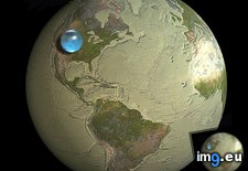
![[Mapporn] Magellan's Circumnavigation of the Earth, from the Portolan Atlas by Battista Agnese, c. 1544. [2235x1482] (#Old #Map #Earth #Atlas) - 574 KB Tags: atlas, earth, map, old (Pict. in My r/MAPS favs)](https://t.im9.eu/mapporn-magellan-s-circumnavigation-of-the-earth-from-the-portolan-atlas-by-battista-agnese-c-1544-2235x1482.jpg) Pict. mapporn-all-the-water-on-earth-presented-as-a-sphere-it-would-have-a-diameter-of-about-860-miles-and-a-volume-around-332-500-000-cubic-miles-1600-1534 (#World #White #Map #Best #Europe #Water #Miles #Geography #Statistics #Presented #Diameter #Sphere #Cubic)Pict. 950×911 px
Pict. mapporn-all-the-water-on-earth-presented-as-a-sphere-it-would-have-a-diameter-of-about-860-miles-and-a-volume-around-332-500-000-cubic-miles-1600-1534 (#World #White #Map #Best #Europe #Water #Miles #Geography #Statistics #Presented #Diameter #Sphere #Cubic)Pict. 950×911 px★ 10k pts. ♥ 0 le gusta ⬇ 5 guardados
 Pict. [Mapporn] Top rated films on IMDb set and shot in each European country [7087x4961] [OC] (#Top #European #Films #Rated #Imdb)Pict. 3544×2481 px
★ 10k pts. ♥ 0 le gusta ⬇ 37 guardados
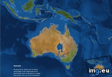
![[Mapporn] Top rated films on IMDb set and shot in each European country [7087x4961] [OC] (#Top #European #Films #Rated #Imdb) - 860 KB Tags: country, european, films, imdb, rated, shot, top (Pict. in My r/MAPS favs)](https://t.im9.eu/mapporn-top-rated-films-on-imdb-set-and-shot-in-each-european-country-7087x4961-oc.jpg) Pict. mapporn-what-australia-and-surrounding-territories-would-look-like-if-all-the-ice-on-earth-were-to-melt-australia-1-024px-766px (#White #Map #Best #Wide #Europe #Ice #Asia #Territories #Melt #Stats #Surrounding #Statistics)Pict. 1024×766 px
Pict. mapporn-what-australia-and-surrounding-territories-would-look-like-if-all-the-ice-on-earth-were-to-melt-australia-1-024px-766px (#White #Map #Best #Wide #Europe #Ice #Asia #Territories #Melt #Stats #Surrounding #Statistics)Pict. 1024×766 px★ 9839 pts. ♥ 0 le gusta ⬇ 8 guardados
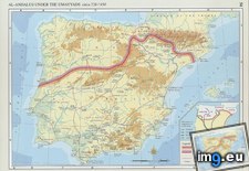
 Pict. mapporn-the-transliterated-arabic-names-of-spanish-and-portuguese-cities-3970-3000 (#World #White #Best #Wide #Usa #History #Geography #Stats #Statistics #Arabic #Portuguese)Pict. 2382×1800 px
★ 9685 pts. ♥ 0 le gusta ⬇ 2 guardados
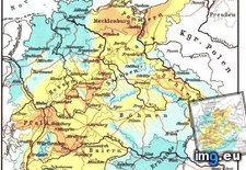
 Pict. mapporn-population-loss-caused-by-war-and-disease-during-the-thirty-years-war-947-1076 (#Years #World #White #Map #Best #Wide #Asia #Disease #Caused #Geography #Loss)Pict. 947×1076 px
★ 9508 pts. ♥ 0 le gusta ⬇ 6 guardados
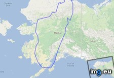
 Pict. mapporn-the-island-of-madagascar-compared-to-alaska-543-524 (#World #White #Map #Wide #Europe #Maps #Asia #Compared #Geography #Stats #Madagascar)Pict. 543×524 px
★ 9355 pts. ♥ 0 le gusta ⬇ 6 guardados
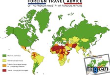
 Pict. mapporn-foreign-travel-advice-of-the-french-ministry-of-foreign-affairs-5600-4130-oc (#World #Map #French #Europe #Usa #Asia #Foreign #Geography #Stats #Affairs #Ministry)Pict. 5600×4137 px
★ 9251 pts. ♥ 0 le gusta ⬇ 4 guardados
 Pict. [Mapporn] Hand crafted topographical map of Banks Peninsula, New Zealand (Contour lines are at 100m intervals. More maps in comm (#New #Map #Are #Hand #Lines #Comm #Contour #Crafted #Intervals)Pict. 960×720 px
★ 9092 pts. ♥ 0 le gusta ⬇ 20 guardados
![[Mapporn] Hand crafted topographical map of Banks Peninsula, New Zealand (Contour lines are at 100m intervals. More maps in comm (#New #Map #Are #Hand #Lines #Comm #Contour #Crafted #Intervals) - 137 KB Tags: are, banks, comm, contour, crafted, hand, intervals, lines, map, maps, new, peninsula, topographical, zealand (Pict. in My r/MAPS favs)](https://t.im9.eu/mapporn-hand-crafted-topographical-map-of-banks-peninsula-new-zealand-contour-lines-are-at-100m-intervals-more-maps-in-comments-oc-960x720.jpg) Pict. [Mapporn] World Map With Lines Joining Constituent Countries, Overseas Departments, and Non-Contiguous States and Territories to (#World #Map #Non #Lines #Contiguous #Territories #Departments #Constituent)Pict. 2638×1196 px
Pict. [Mapporn] World Map With Lines Joining Constituent Countries, Overseas Departments, and Non-Contiguous States and Territories to (#World #Map #Non #Lines #Contiguous #Territories #Departments #Constituent)Pict. 2638×1196 px★ 8953 pts. ♥ 0 le gusta ⬇ 15 guardados
![[Mapporn] World Map With Lines Joining Constituent Countries, Overseas Departments, and Non-Contiguous States and Territories to (#World #Map #Non #Lines #Contiguous #Territories #Departments #Constituent) - 255 KB Tags: constituent, contiguous, countries, departments, joining, lines, map, non, overseas, states, territories, world (Pict. in My r/MAPS favs)](https://t.im9.eu/mapporn-world-map-with-lines-joining-constituent-countries-overseas-departments-and-non-contiguous-states-and-territories-to-their-respective-countries-2638x1196-oc.jpg) Pict. [Mapporn] World Map showing the full extent of the European Union (including its Outermost Regions), its Overseas Countries and (#World #Map #Full #Showing #Including #Overseas #Extent #Outermost)Pict. 2206×1358 px
Pict. [Mapporn] World Map showing the full extent of the European Union (including its Outermost Regions), its Overseas Countries and (#World #Map #Full #Showing #Including #Overseas #Extent #Outermost)Pict. 2206×1358 px★ 8931 pts. ♥ 0 le gusta ⬇ 9 guardados
![[Mapporn] World Map showing the full extent of the European Union (including its Outermost Regions), its Overseas Countries and (#World #Map #Full #Showing #Including #Overseas #Extent #Outermost) - 288 KB Tags: countries, european, extent, full, including, map, outermost, overseas, regions, showing, union, world (Pict. in My r/MAPS favs)](https://t.im9.eu/mapporn-world-map-showing-the-full-extent-of-the-european-union-including-its-outermost-regions-its-overseas-countries-and-territories-exclusive-economic-zones-and-antarctic-claims-2206x1358.jpg) Pict. [Mapporn] Opening the ISLSCP II data in Microsoft Excel and applying conditional formatting gives you a world population density (#You #World #Population #Data #Excel #Conditional #Formatting #Islscp)Pict. 1920×1039 px
Pict. [Mapporn] Opening the ISLSCP II data in Microsoft Excel and applying conditional formatting gives you a world population density (#You #World #Population #Data #Excel #Conditional #Formatting #Islscp)Pict. 1920×1039 px★ 8820 pts. ♥ 0 le gusta ⬇ 11 guardados
![[Mapporn] Opening the ISLSCP II data in Microsoft Excel and applying conditional formatting gives you a world population density (#You #World #Population #Data #Excel #Conditional #Formatting #Islscp) - 202 KB Tags: applying, conditional, data, density, excel, formatting, islscp, microsoft, opening, population, world, you (Pict. in My r/MAPS favs)](https://t.im9.eu/mapporn-opening-the-islscp-ii-data-in-microsoft-excel-and-applying-conditional-formatting-gives-you-a-world-population-density-map-in-less-than-a-minute-1920x1039-oc.jpg) Pict. [Mapporn] Predictive density map of an estimated 5 trillion plastic pieces polluting the world's oceans, split into 4 size categ (#World #Map #Size #Density #Oceans #Trillion #Categ #Polluting #Predictive)Pict. 1885×1081 px
Pict. [Mapporn] Predictive density map of an estimated 5 trillion plastic pieces polluting the world's oceans, split into 4 size categ (#World #Map #Size #Density #Oceans #Trillion #Categ #Polluting #Predictive)Pict. 1885×1081 px★ 8769 pts. ♥ 0 le gusta ⬇ 12 guardados
![[Mapporn] Predictive density map of an estimated 5 trillion plastic pieces polluting the world's oceans, split into 4 size categ (#World #Map #Size #Density #Oceans #Trillion #Categ #Polluting #Predictive) - 292 KB Tags: categ, density, estimated, map, oceans, pieces, plastic, polluting, predictive, size, split, trillion, world (Pict. in My r/MAPS favs)](https://t.im9.eu/mapporn-predictive-density-map-of-an-estimated-5-trillion-plastic-pieces-polluting-the-world-s-oceans-split-into-4-size-categories-source-in-comments-1885-x-1081.jpg) Pict. [Mapporn] If countries-disputed territories-national parks moved to provinces and regions of Belgium with similar areas [OS] [48 (#National #Countries #Moved #Areas #Belgium #Parks #Disputed)Pict. 487×434 px
Pict. [Mapporn] If countries-disputed territories-national parks moved to provinces and regions of Belgium with similar areas [OS] [48 (#National #Countries #Moved #Areas #Belgium #Parks #Disputed)Pict. 487×434 px★ 8764 pts. ♥ 0 le gusta ⬇ 10 guardados
![[Mapporn] If countries-disputed territories-national parks moved to provinces and regions of Belgium with similar areas [OS] [48 (#National #Countries #Moved #Areas #Belgium #Parks #Disputed) - 51 KB Tags: areas, belgium, countries, disputed, moved, national, parks, provinces, regions, similar, territories (Pict. in My r/MAPS favs)](https://t.im9.eu/mapporn-if-countries-disputed-territories-national-parks-moved-to-provinces-and-regions-of-belgium-with-similar-areas-os-487x434.jpg) Pict. [Mapporn] Percentage of European population with patrilineal Y-DNA considered to be characteristic of Germanic peoples[800x545] (#European #Population #Percentage #Germanic #800x545 #Characteristic #Patrilineal)Pict. 800×545 px
Pict. [Mapporn] Percentage of European population with patrilineal Y-DNA considered to be characteristic of Germanic peoples[800x545] (#European #Population #Percentage #Germanic #800x545 #Characteristic #Patrilineal)Pict. 800×545 px★ 8762 pts. ♥ 0 le gusta ⬇ 14 guardados
![[Mapporn] Percentage of European population with patrilineal Y-DNA considered to be characteristic of Germanic peoples[800x545] (#European #Population #Percentage #Germanic #800x545 #Characteristic #Patrilineal) - 73 KB Tags: 800x545, characteristic, considered, dna, european, germanic, patrilineal, peoples, percentage, population (Pict. in My r/MAPS favs)](https://t.im9.eu/mapporn-percentage-of-european-population-with-patrilineal-y-dna-considered-to-be-characteristic-of-germanic-peoples-800x545.jpg) Pict. [Mapporn] 1752, Joseph Nicolas Delisle and Philippe Buache. Carte des Nouvelles Decouvertes. Interesting map of the world I foun (#World #Map #Interesting #Des #Buache #Decouvertes #Delisle #Foun #Nouvelles)Pict. 1937×1375 px
Pict. [Mapporn] 1752, Joseph Nicolas Delisle and Philippe Buache. Carte des Nouvelles Decouvertes. Interesting map of the world I foun (#World #Map #Interesting #Des #Buache #Decouvertes #Delisle #Foun #Nouvelles)Pict. 1937×1375 px★ 8726 pts. ♥ 0 le gusta ⬇ 18 guardados
![[Mapporn] 1752, Joseph Nicolas Delisle and Philippe Buache. Carte des Nouvelles Decouvertes. Interesting map of the world I foun (#World #Map #Interesting #Des #Buache #Decouvertes #Delisle #Foun #Nouvelles) - 506 KB Tags: buache, carte, decouvertes, delisle, des, foun, interesting, joseph, map, nicolas, nouvelles, philippe, world (Pict. in My r/MAPS favs)](https://t.im9.eu/mapporn-1752-joseph-nicolas-delisle-and-philippe-buache-carte-des-nouvelles-decouvertes-interesting-map-of-the-world-i-found-by-accident-1937x1375.jpg) Pict. [Mapporn] Percentage of European population attending domestic football leagues (2100x1525) [OC] (details & numbered version (#European #Population #Football #Domestic #Leagues #Attending #Numbered)Pict. 2100×1525 px
Pict. [Mapporn] Percentage of European population attending domestic football leagues (2100x1525) [OC] (details & numbered version (#European #Population #Football #Domestic #Leagues #Attending #Numbered)Pict. 2100×1525 px★ 8722 pts. ♥ 0 le gusta ⬇ 23 guardados
![[Mapporn] Percentage of European population attending domestic football leagues (2100x1525) [OC] (details & numbered version (#European #Population #Football #Domestic #Leagues #Attending #Numbered) - 273 KB Tags: 2100x1525, attending, details, domestic, european, football, leagues, numbered, percentage, population (Pict. in My r/MAPS favs)](https://t.im9.eu/mapporn-percentage-of-european-population-attending-domestic-football-leagues-2100x1525-oc-details-numbered-version-in-comments.jpg) GIF [Mapporn] Lake Powell water level dropping and rising at Bullfrog & Hall's Crossing Marinas. [750x576][GIF] (#Gif #Lake #Water #Level #Powell #750x576 #Bullfrog #Marinas)GIF 750×576 px
GIF [Mapporn] Lake Powell water level dropping and rising at Bullfrog & Hall's Crossing Marinas. [750x576][GIF] (#Gif #Lake #Water #Level #Powell #750x576 #Bullfrog #Marinas)GIF 750×576 px★ 8655 pts. ♥ 0 le gusta ⬇ 10 guardados
![[Mapporn] Lake Powell water level dropping and rising at Bullfrog & Hall's Crossing Marinas. [750x576][GIF] (#Gif #Lake #Water #Level #Powell #750x576 #Bullfrog #Marinas) - 5.2 MB Tags: 750x576, bullfrog, crossing, dropping, gif, hall, lake, level, marinas, powell, rising, water (GIF in My r/MAPS favs)](https://t.im9.eu/mapporn-lake-powell-water-level-dropping-and-rising-at-bullfrog-hall-s-crossing-marinas-750x576-gif.jpg) Pict. [Mapporn] Percentage of European population with patrilineal Y-DNA considered to be characteristic of 'Italo-Celtic' peoples [80 (#European #Population #Percentage #Considered #Characteristic #Italo #Patrilineal)Pict. 800×545 px
Pict. [Mapporn] Percentage of European population with patrilineal Y-DNA considered to be characteristic of 'Italo-Celtic' peoples [80 (#European #Population #Percentage #Considered #Characteristic #Italo #Patrilineal)Pict. 800×545 px★ 8632 pts. ♥ 0 le gusta ⬇ 13 guardados
![[Mapporn] Percentage of European population with patrilineal Y-DNA considered to be characteristic of 'Italo-Celtic' peoples [80 (#European #Population #Percentage #Considered #Characteristic #Italo #Patrilineal) - 72 KB Tags: celtic, characteristic, considered, dna, european, italo, patrilineal, peoples, percentage, population (Pict. in My r/MAPS favs)](https://t.im9.eu/mapporn-percentage-of-european-population-with-patrilineal-y-dna-considered-to-be-characteristic-of-italo-celtic-peoples-800x545.jpg) Pict. [Mapporn] United Nations General Assembly voting on draft resolution for support of the territorial integrity of Ukraine [2750x1 (#General #Ukraine #United #Resolution #Draft #Assembly #Integrity)Pict. 2753×1400 px
Pict. [Mapporn] United Nations General Assembly voting on draft resolution for support of the territorial integrity of Ukraine [2750x1 (#General #Ukraine #United #Resolution #Draft #Assembly #Integrity)Pict. 2753×1400 px★ 8602 pts. ♥ 0 le gusta ⬇ 14 guardados
![[Mapporn] United Nations General Assembly voting on draft resolution for support of the territorial integrity of Ukraine [2750x1 (#General #Ukraine #United #Resolution #Draft #Assembly #Integrity) - 313 KB Tags: assembly, draft, general, integrity, nations, resolution, support, territorial, ukraine, united, voting (Pict. in My r/MAPS favs)](https://t.im9.eu/mapporn-united-nations-general-assembly-voting-on-draft-resolution-for-support-of-the-territorial-integrity-of-ukraine-2750x1400.jpg) Pict. [Mapporn] Map of the European Economic Area (+Croatia) showing EEA Migration Percentages and Origins of the Largest EEA Migrant (#Map #Showing #European #Area #Eea #Migration #Percentages #Migrant)Pict. 1380×1040 px
Pict. [Mapporn] Map of the European Economic Area (+Croatia) showing EEA Migration Percentages and Origins of the Largest EEA Migrant (#Map #Showing #European #Area #Eea #Migration #Percentages #Migrant)Pict. 1380×1040 px★ 8579 pts. ♥ 0 le gusta ⬇ 16 guardados
![[Mapporn] Map of the European Economic Area (+Croatia) showing EEA Migration Percentages and Origins of the Largest EEA Migrant (#Map #Showing #European #Area #Eea #Migration #Percentages #Migrant) - 218 KB Tags: area, croatia, economic, eea, european, largest, map, migrant, migration, origins, percentages, showing (Pict. in My r/MAPS favs)](https://t.im9.eu/mapporn-map-of-the-european-economic-area-croatia-showing-eea-migration-percentages-and-origins-of-the-largest-eea-migrant-groups-in-each-country-created-by-u-prigby-1380x1040.jpg) Pict. [Mapporn] Age of Vikings - Scandinavian settlements in the 8th - 11th century [2000x1314] (#Age #Century #11th #Scandinavian #Settlements)Pict. 2000×1314 px
Pict. [Mapporn] Age of Vikings - Scandinavian settlements in the 8th - 11th century [2000x1314] (#Age #Century #11th #Scandinavian #Settlements)Pict. 2000×1314 px★ 8539 pts. ♥ 0 le gusta ⬇ 31 guardados
![[Mapporn] Age of Vikings - Scandinavian settlements in the 8th - 11th century [2000x1314] (#Age #Century #11th #Scandinavian #Settlements) - 321 KB Tags: 8th, 11th, age, century, scandinavian, settlements, vikings (Pict. in My r/MAPS favs)](https://t.im9.eu/mapporn-age-of-vikings-scandinavian-settlements-in-the-8th-11th-century-2000x1314.jpg) Pict. [Mapporn] Share of renewable energies in gross final energy consumption by country in the European Economic Area, Switzerland an (#Share #European #Country #Area #Consumption #Economic #Energies)Pict. 703×581 px
Pict. [Mapporn] Share of renewable energies in gross final energy consumption by country in the European Economic Area, Switzerland an (#Share #European #Country #Area #Consumption #Economic #Energies)Pict. 703×581 px★ 8524 pts. ♥ 0 le gusta ⬇ 7 guardados
![[Mapporn] Share of renewable energies in gross final energy consumption by country in the European Economic Area, Switzerland an (#Share #European #Country #Area #Consumption #Economic #Energies) - 65 KB Tags: area, consumption, country, economic, energies, energy, european, final, gross, share, switzerland (Pict. in My r/MAPS favs)](https://t.im9.eu/mapporn-share-of-renewable-energies-in-gross-final-energy-consumption-by-country-in-the-european-economic-area-switzerland-and-turkey-703x581.jpg)